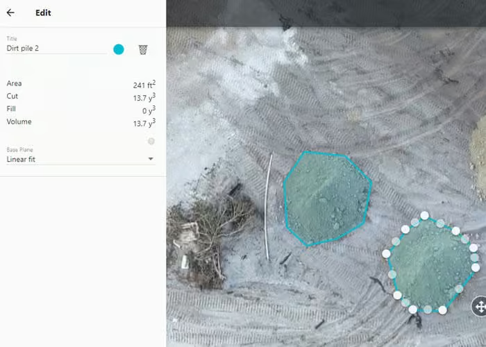
Edge Construction

Utilizing drones in the construction industry, we provide progress tracking, volumetric analysis, 3-D mapping and more. Construction management has never been easier!

Efficient & Accurate Imagery

Capture high-resolution images of your construction site with efficiency and accuracy.

An orthomosaic map can enable the detailed viewing of an overall property.

An orthomosaic map can enable the detailed viewing of an overall property.

Volumetric mapping enables dirt tracking over time.

Volumetric analysis enables dirt tracking over time.

In-Depth Analysis

Process and create actionable data with our cutting edge tools, including orthomosaic mapping, volumetric analysis, 3-D modeling, and more.

Actionable Results

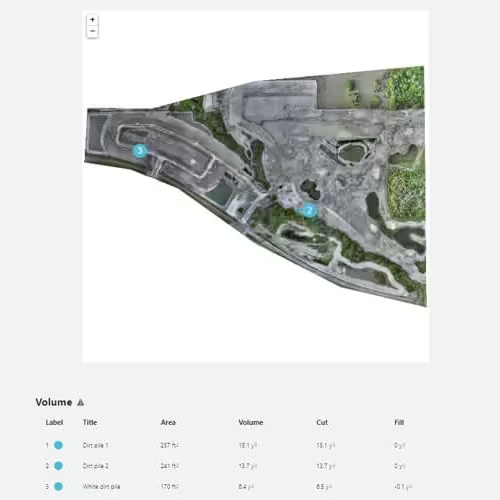
Receive feedback and actionable data to ensure timeliness of your project.

Leverage volumetric data to ensure your schedules are kept on track.

Leverage volumetric data to ensure your schedules are kept on track.

Let's Get Started

Let Edge Drone Services help you make critical decisions easier and faster.

LET'S GET STARTED

Let Edge Drone Services help you make critical decisions easier and faster.

Thank you for contacting us! We'll be in touch!